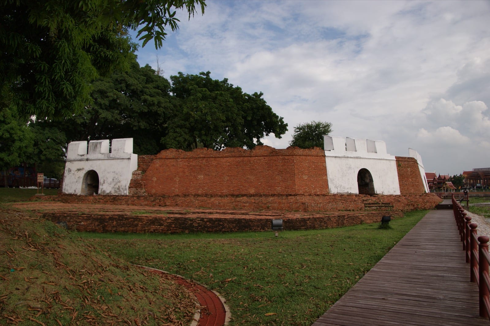
Built under King Maha Chakkraphat, mid-1500s CE — rebuilt under King Narai, 1663 CE
Pom Phet (Diamond Fort)
Look to the island's south-eastern corner, where the Pa Sak River pours into the Chao Phraya. That low brick rampart rising from the bank is Pom Phet — the strongest and most important of Ayutthaya's ring of city-wall forts. King Maha Chakkraphat raised it in brick and laterite in the mid-1500s, in the sober years after Ayutthaya's first great war with Burma, once the kingdom had entered the age of gunpowder. Its walls run some fourteen metres thick, its hexagonal bastion thrusting out beyond the city wall, pierced by eight cannon ports that swept the water. Every foreign ship sailing up the river had to drop anchor here for inspection before it could reach the capital — none passed this point uncleared. King Narai had a Sicilian Jesuit engineer rebuild it in 1663. When most of Ayutthaya's forts were later stripped for brick to raise Bangkok, Pom Phet survived — one of only two forts still standing.
The Engineering of a Gunpowder-Age Fortress
Pom Phet was founded on brick and laterite, the paired materials Ayutthaya's builders trusted most. Laterite absorbed the shock and the river damp; brick faced the outer skin in a smoother wall; and the core between was packed with rubble and fill until, in places, the rampart reached a thickness of some fourteen metres. Such mass was the point, for it was designed to swallow the force of cannon fire in an age when heavy guns were remaking war. The parapet stood roughly six and a half metres high, with a walkway broad enough to move men, powder and shot along its length.
Older records describe eight cannon ports opening across the water, with further guns mounted on carriages below. The fort's very shape shifted with the centuries: a 1665 painting by Johannes Vingboons still shows it round, before later works drew it into an angled bastion thrusting beyond the wall. The redesign erased the blind corners a circular fort leaves and widened the field of fire — a principle of European fortification quietly married to Siamese craft.
Maha Chakkraphat, the Burmese Wars, and the Ring of City Forts
Pom Phet was born of a lesson taught by war. King Maha Chakkraphat reigned from about 1548 to 1569, and soon after Ayutthaya's first great clash with Burma around 1549 he pressed to strengthen the capital's defences. Prince Damrong attributed both Pom Phet and its companion Pom Sattakop to this reign, when the king grasped that Ayutthaya had entered the age of gunpowder and that heavy guns had come to decide the battlefield.
The fort never stood alone. It was the most important node in a ring of forts and city walls that girdled the island capital on every side, spaced along ramparts that hugged the encircling rivers and watched each approach to the city. Set at the south-eastern corner where the waters meet, Pom Phet was fortified with particular care — the first gate that an enemy fleet, or a foreign merchantman, would have to answer before reaching the capital.
The Customs Gate, Narai's Rebuild, and Survival to Our Day
In the great age of trade no foreign ship travelling up the Chao Phraya was permitted beyond this point. Pom Phet served as the checkpoint and customs house: every vessel dropped anchor here to be inspected and to unload before it was cleared for the capital. The river-mouth site was therefore not only strategic but a gate of commerce, through which much of the kingdom's wealth was made to pass.
Under King Narai, around 1663, the capital's walls and forts were extensively rebuilt under the direction of Tomaso Valguarnera, a Sicilian Jesuit, in works that continued for years afterward. Later, at the founding of Bangkok, when most of Ayutthaya's forts were stripped of brick to raise the new capital, Pom Phet was spared — one of only two of the old city's forts still standing today. It now survives, restored, as a riverside public park.
Seen from the River, Where the Waters Meet
From the deck, Pom Phet appears as a low line of reddish-brown brick, crouched at the corner where the Pa Sak pours down into the Chao Phraya. Here the river broadens and two currents meet, so the surface ripples where they join. What once rose as a towering wall is now chiefly parapet and laterite footing — yet it is still legible enough to read that cannon once swept the very stretch of water before you.
In the soft light of early morning or evening the old brick warms to gold, set against the shade of the bankside trees and the glint of the water. The scene is quiet enough to forget that this was once the busiest gate of the capital, where every vessel was made to halt. To drift slowly past it is to follow the wake of the junks and warships that entered Ayutthaya centuries ago.
Did you know
Did you know? The name "Pom Phet" means "Diamond Fort" — a nod to its reputation as Ayutthaya's toughest bastion, and the customs gate where every foreign ship had to halt before reaching the capital.
Frequently asked questions
When was Pom Phet (Diamond Fort) built, and by whom?+
It is generally attributed to the reign of King Maha Chakkraphat (about 1548–1569), soon after the first Burmese war around 1549. It was later extensively rebuilt from about 1663 under King Narai, directed by the Sicilian Jesuit Tomaso Valguarnera.
Why is it called the “Diamond Fort”?+
The name signals its standing as the strongest and most important of the city's forts — hard as a diamond — and its role as the customs gate where every foreign ship had to halt for inspection before reaching the capital.
Why does Pom Phet still stand when almost all the other forts are gone?+
At the founding of Bangkok, most of Ayutthaya's forts and walls were stripped of brick to build the new capital. Pom Phet was spared and remains one of only two of the old city's forts still standing today, now kept as a riverside public park.
How can I see Pom Phet from the river?+
Pom Phet sits at the island's south-eastern corner, where the Pa Sak flows into the Chao Phraya, so it is clearly visible from boats tracing the island's edge. It is one of the sights on Mercury Cruise's island-loop route, which passes before the fort while telling its story from the water.
© Daniel R. Witte, Wikimedia Commons (CC BY-SA)